Journal Information
Published at the ISPRS Journal of Photogrammetry and Remote Sensing.
Abstract
Generating learning-friendly representations for points in space is a fundamental and long-standing problem in machine learning. Recently, multi-scale encoding schemes (such as Space2Vec and NeRF) were proposed to directly encode any point in 2D or 3D Euclidean space as a high-dimensional vector, and has been successfully applied to various (geo)spatial prediction and generative tasks. However, all current 2D and 3D location encoders are designed to model point distances in Euclidean space. So when applied to large-scale real-world GPS coordinate datasets (e.g., species or satellite images taken all over the world), which require distance metric learning on the spherical surface, both types of models can fail due to the map projection distortion problem (2D) and the spherical-to-Euclidean distance approximation error (3D).
To solve these problems, we propose a multi-scale location encoder called Sphere2Vec which can preserve spherical distances when encoding point coordinates on a spherical surface. We developed a unified view of distance-reserving encoding on spheres based on the Double Fourier Sphere (DFS). We also provide theoretical proof that the Sphere2Vec encoding preserves the spherical surface distance between any two points, while existing encoding schemes such as Space2Vec and NeRF do not.
Experiments on 20 synthetic datasets show that Sphere2Vec can outperform all baseline models including the state-of-the-art (SOTA) 2D location encoder (i.e., Space2Vec) and 3D encoder NeRF on all these datasets with up to 30.8% error rate reduction. We then apply Sphere2Vec to three geo-aware image classification tasks - fine-grained species recognition, Flickr image recognition, and remote sensing image classification. Results on 7 real-world datasets show the superiority of Sphere2Vec over multiple 2D and 3D location encoders on all three tasks. Further analysis shows that Sphere2Vec outperforms other location encoder models, especially in the polar regions and data-sparse areas because of its nature for spherical surface distance preservation.
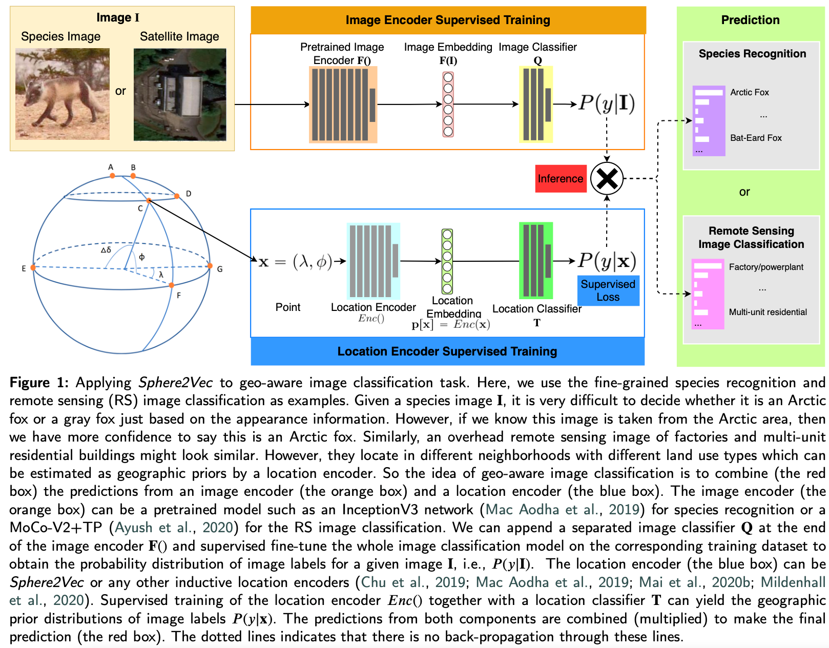
Sphere2Vec Overview
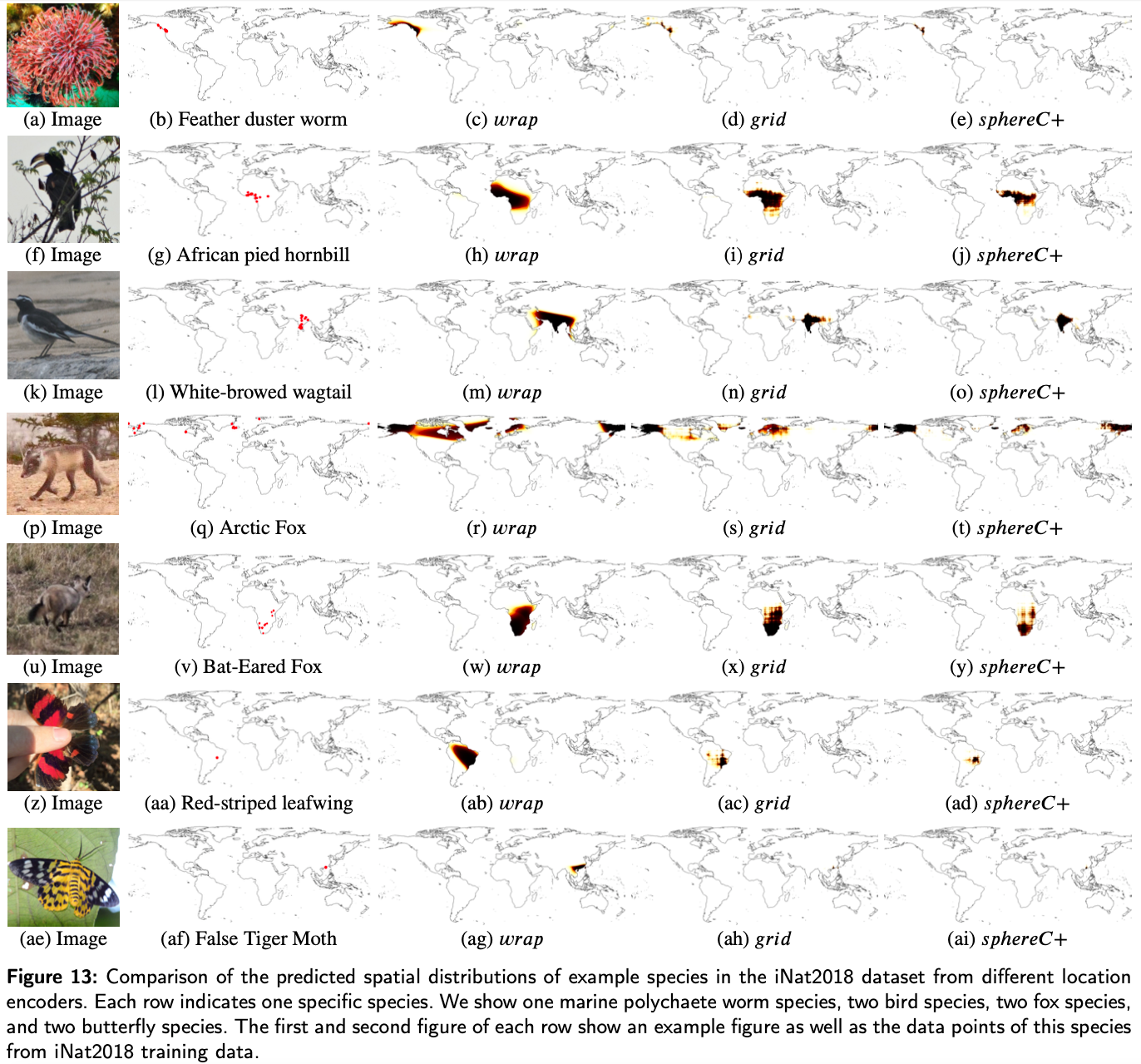
The predicted spatial distributions of example species in the iNat2018 dataset
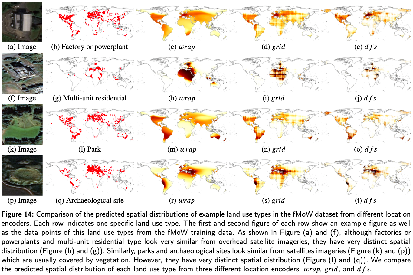
The predicted spatial distributions of example land use types in the fMoW dataset